
MGC Click Before You Dig
DIY Enquiry of Utility Maps
MGC Click Before You Dig creates maximum transparency and efficiency in the provision of information to registered contractual partners such as planning or construction companies, as well as internal employees.
The application guides you step-by-step through the enquiry process in a self-explanatory manner, from the entry of the construction measure to PDF generation – legally compliant with industry guidelines as well as security management.
Thanks to an integrated process engine, we can quickly and easily implement your individual needs in the enquiry process – for example authorisation processes or automatic notifications. MGC Click Before You Dig offers internal employees additional functions and visibilities.
- Legally compliant line information for external and internal parties
- Highest flexibility through integrated process engine
- Easy integration into portal solutions
- Convenient (user) administration
- Reduced workload for the map enquiry department
Do it yourself!
Self-service portals cover over 90% of all map enquiries!
MGC Click Before You Dig for third parties
MGC Click Before You Dig automates the enquiry process for the convenient provision of asset maps for external planning and construction companies during construction work in the network area.
The goal is to increase the efficiency of the enquiry process through a high degree of automation and the use of the self-service principle.
- Process-controlled web application for the creation and management of map requests
- Step-by-step recording of all data relevant to construction measures and geographical information
- Support of the legal duty to provide information on the enquiry process according to industry guidelines
- Flexible process model for illustrating individual requirements
- Legally secure documentation of requests and documents
- Automatic plot generation including all written documents
- Central database storage of all documents and requests with time stamp
- Provision of enquiry documents via e-mail or as a download
Registration
- Confirmation of the user agreement
- Authentication process
- Automatic mail notification
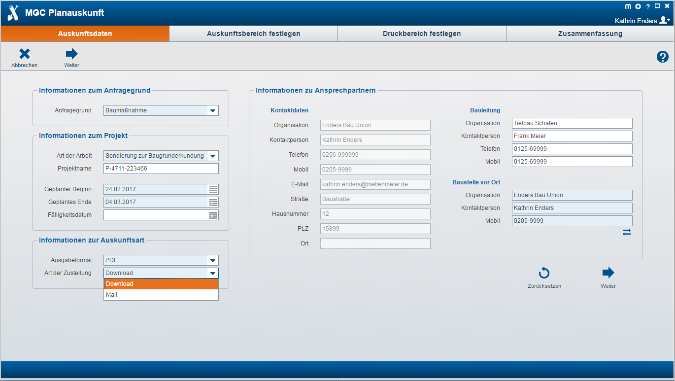
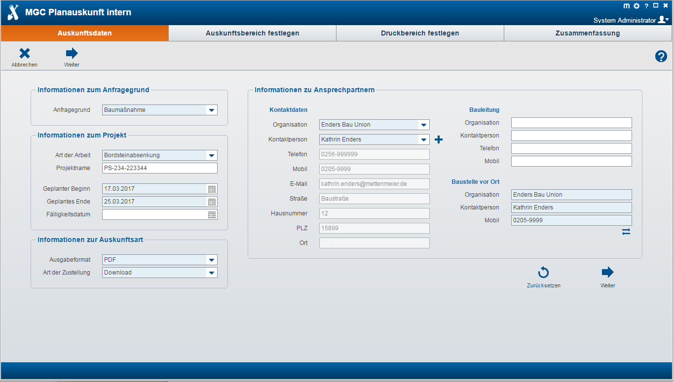
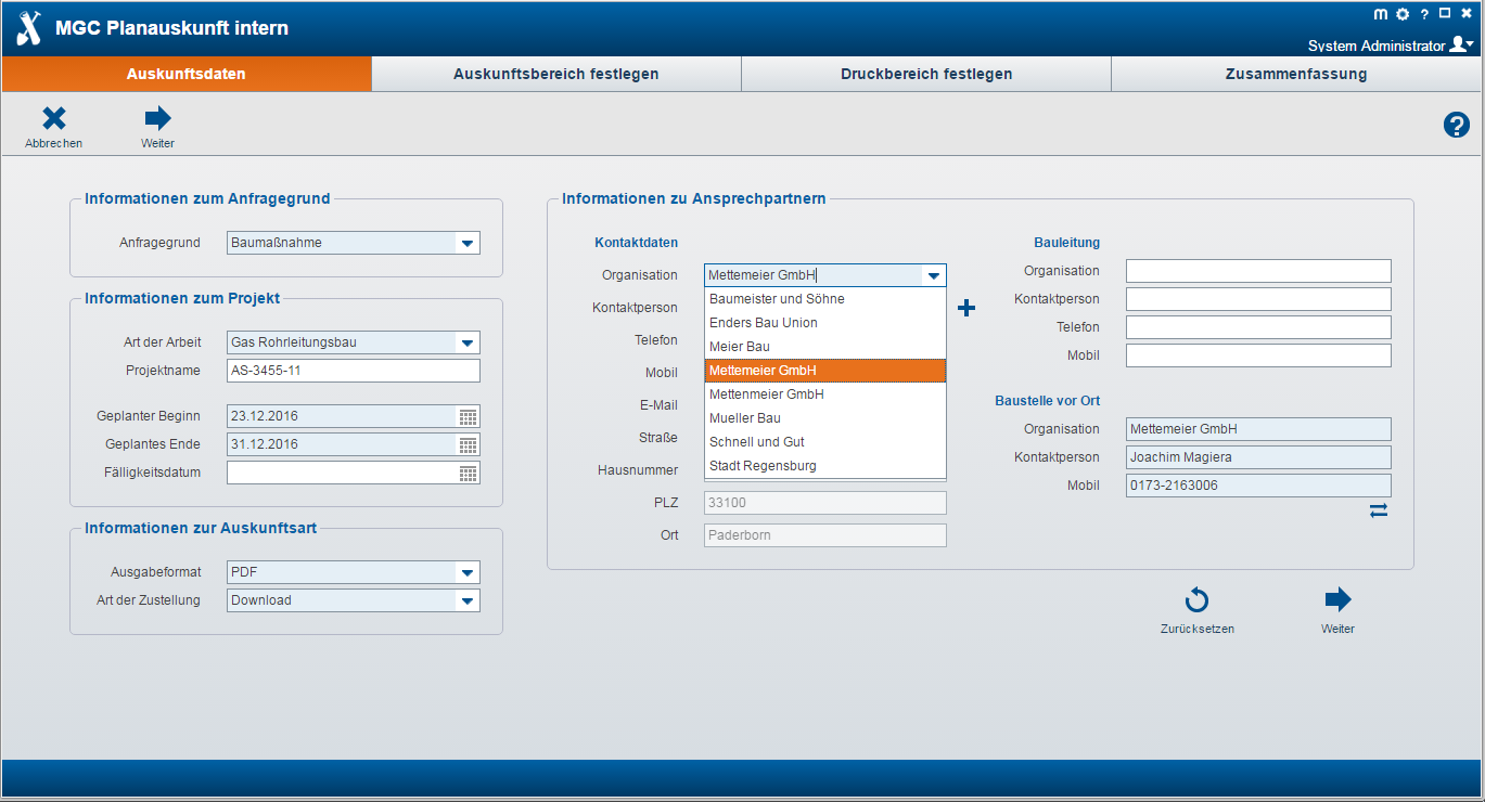
Enquiry Data
- Recording of all project-relevant information with convenient input functions supported by selection lists and mandatory fields
- Calendar function
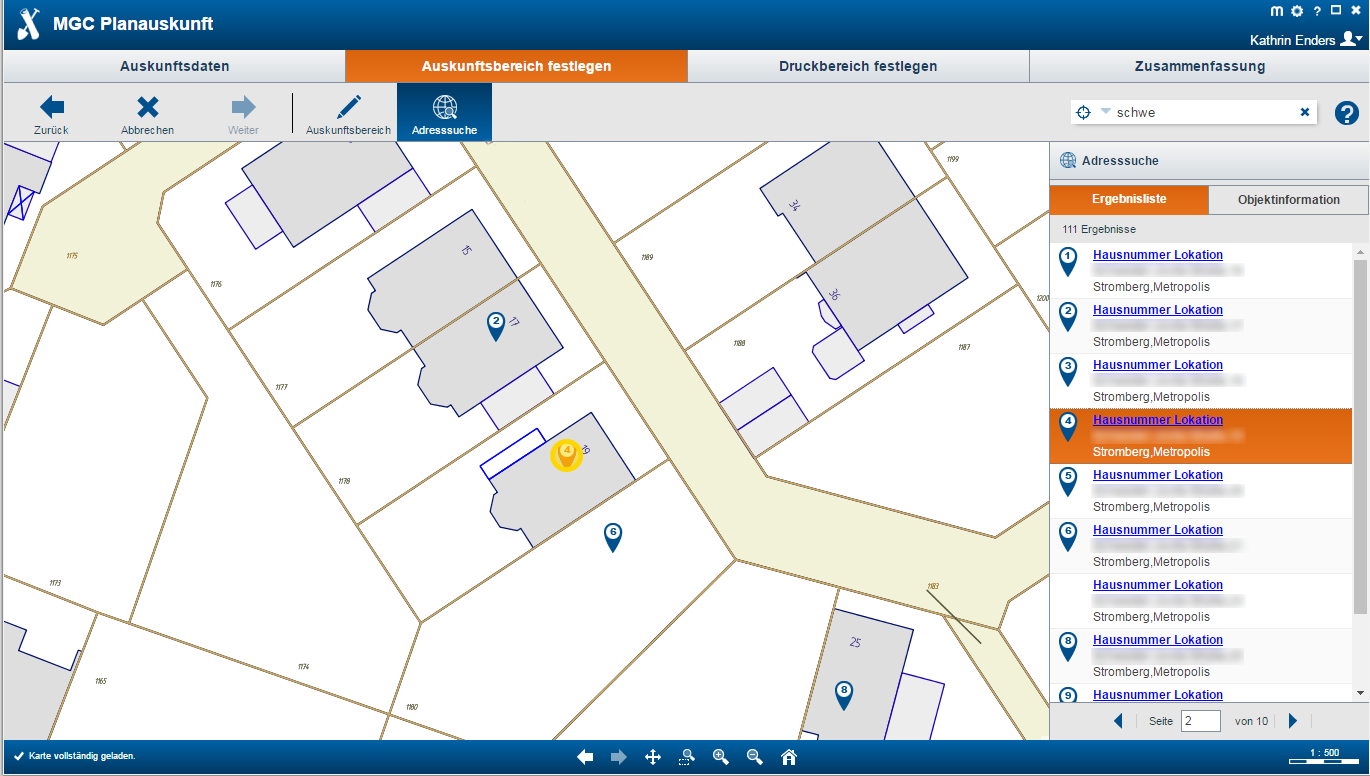
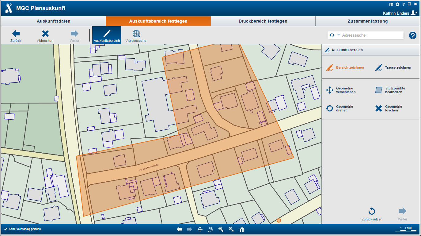
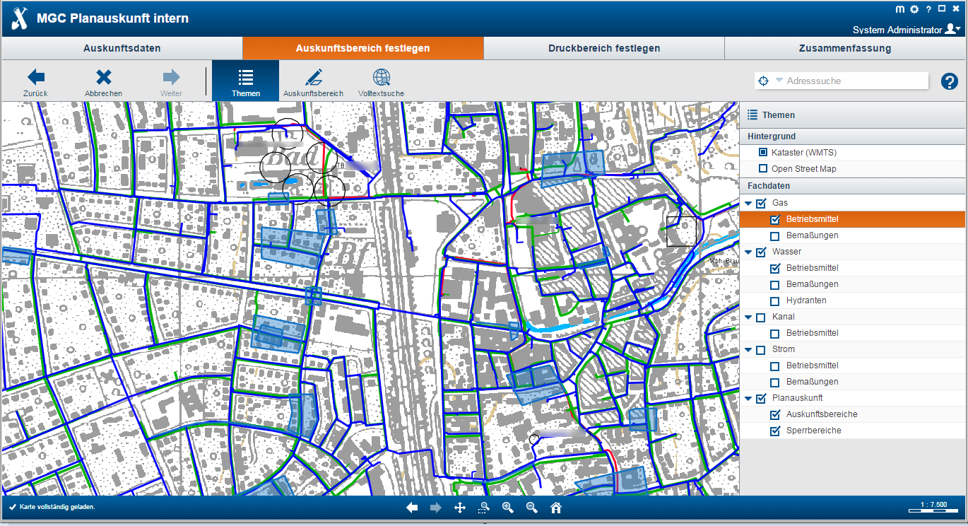
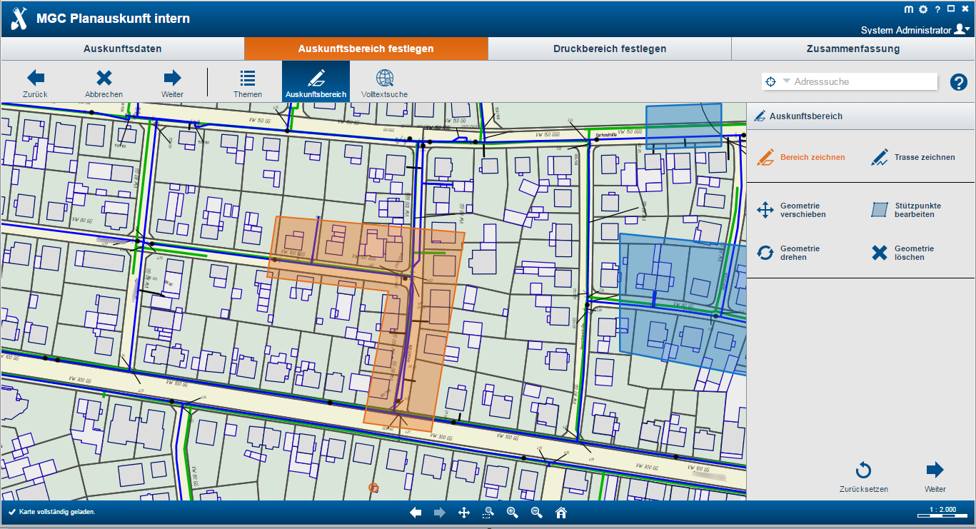
Define Areas of Enquiry
- Display of cadastral or OSM data
- Integrated full-text search for easy navigation
- Spatial definition of the construction measure by recording the area or the utility line
- Integrated checking of the maximum permissible area size and the overlapping with restricted areas
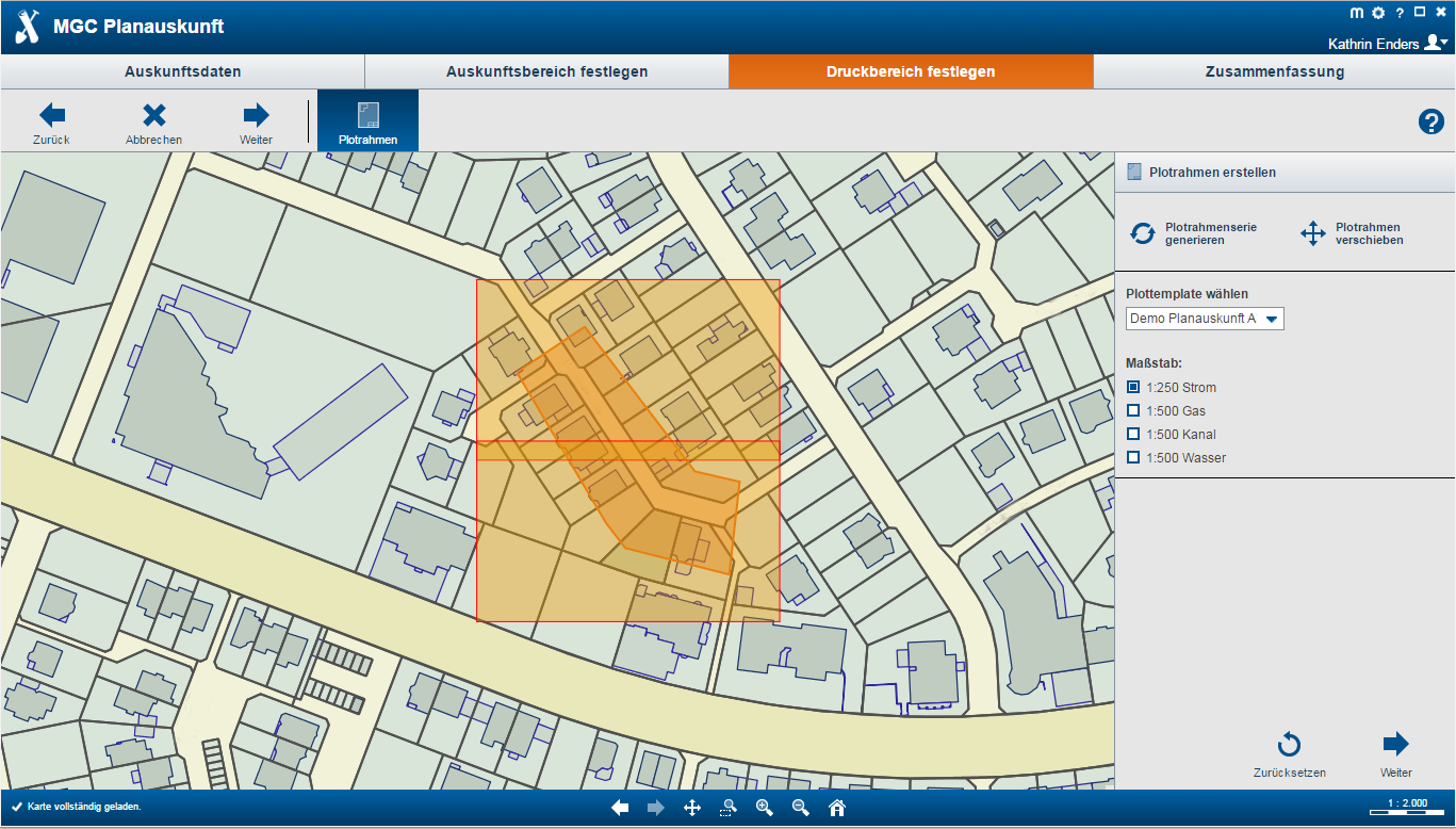
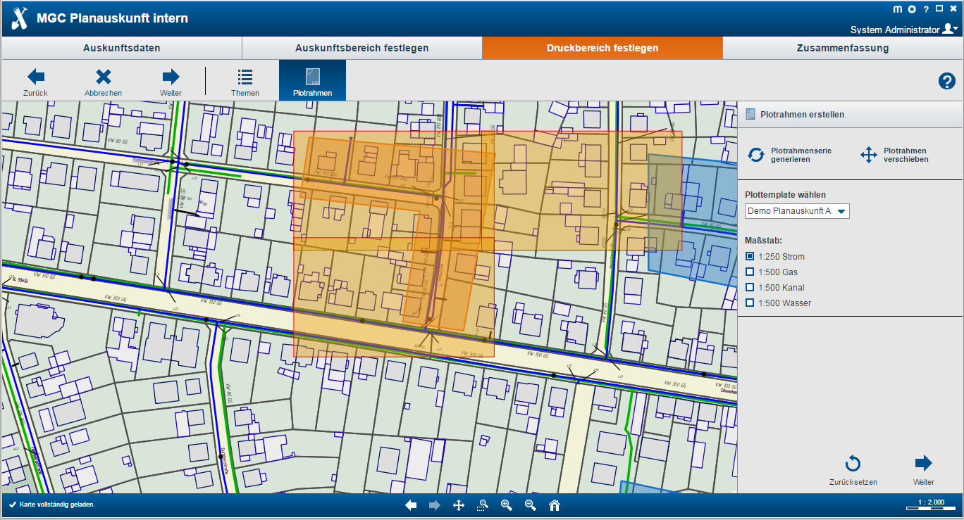
Define Print Area
- Automatic plot frame generation
- Division-specific configuration
- Optional free scale selection for all divisions or division-specific specifications
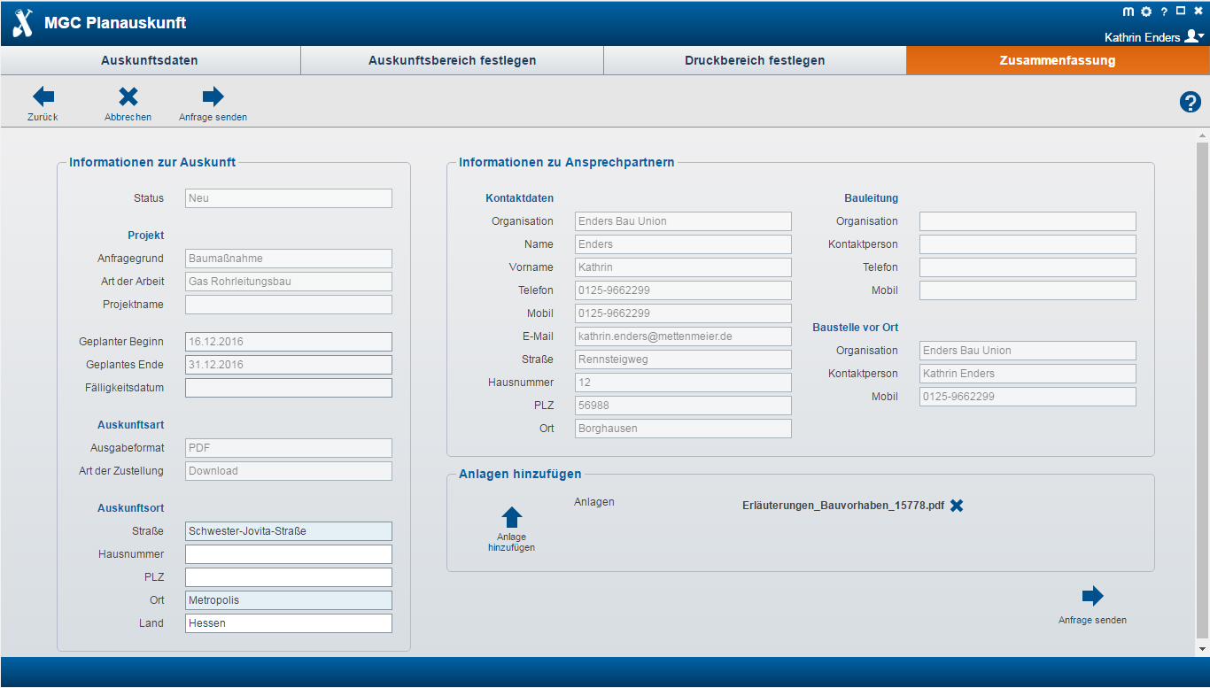
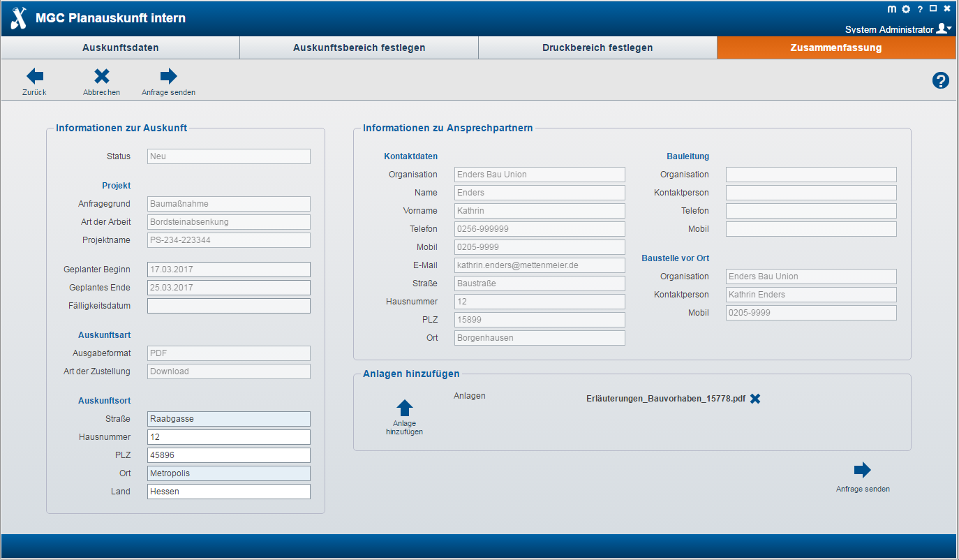
Summary
- Summary of all input data for the map enquiry system
- Possibility to upload documents
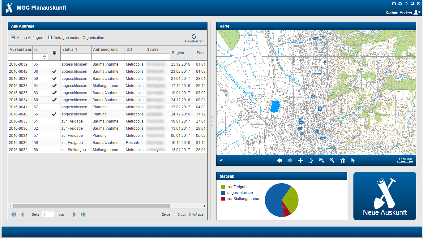
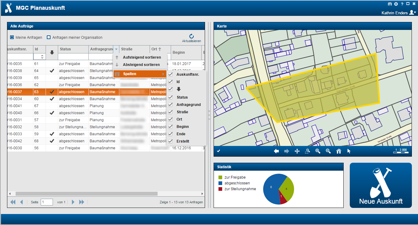
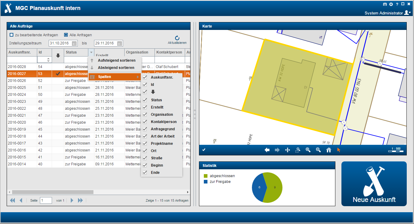
Dashboard
- Overview of own requests and requests of the organisation
- Filtering function
- Sorting function
- Map support
- Statistics
- Possibility of logged download
Other Functions
- Generation of plots with validity date and overview sheet
- Mail notification at delivery
- Legally secure storage
- Optional release process
MGC Click Before You Dig for internal staff
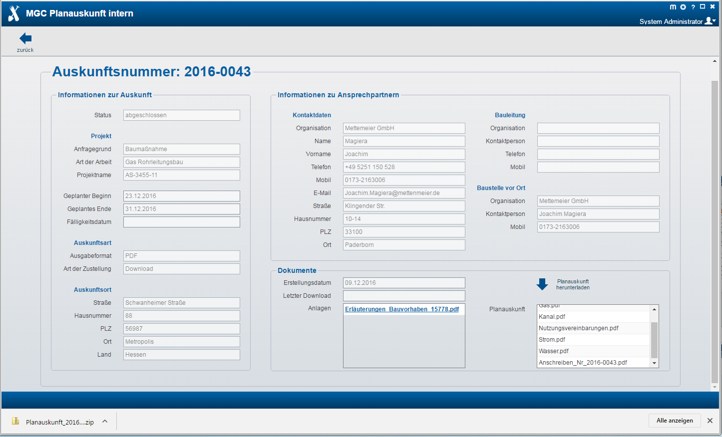
The MGC Click Before You Dig for internal staff supports the employees of utility companies in the automated creation of map enquiries for third parties, the processing of comments and the release of externally requested map enquiries.
The goal is to increase efficiency and transparency in the enquiry process through a uniform approach.
- Process-controlled web application for internal processing of map enquiries
- Complete processing according to the industry specifications and legal requirements
- Processing of "enquiries at the counter/telephone" for contracted construction companies, but also for purely internal use
- Creation and selection of the requesting companies
- Step-by-step recording of all data relevant to construction measures and geographical data
- Automatic plot generation including all written documents
- Provision of the results via mail or as a download
- Flexible process model for displaying individual requirements
- Storage of all documents and request data with time stamp in a database
- Legally secure documentation of enquiries
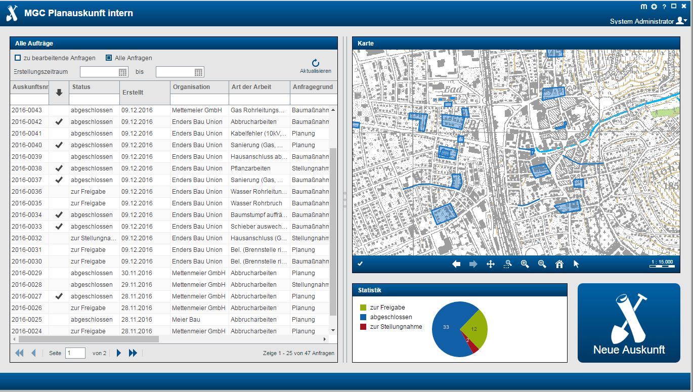
Dashboard
- Overview of all enquiries to be processed or all enquiries
- Filter and sorting functions
- Map support
- Statistics
- Restriction of the creation period
Enquiry Data
- Acquisition of all measure-relevant information by means of convenient, clear input functions
- Selection lists and mandatory fields
- Calendar selection
- Selection and new creation of an organisation/user
Define Enquiry Area
- Optional representation of the entire network
- Topic control
- Integrated full-text search for easy address navigation
- Spatial definition of the measure by recording an area or a single-line
- Integrated check of the maximum permissible area size and overlapping with configurable restricted areas
Define Print Area
- Automatic plot frame generation via the enquiry area or along the single-line
- Optional free scale selection for all divisions or division-specific fixed specifications
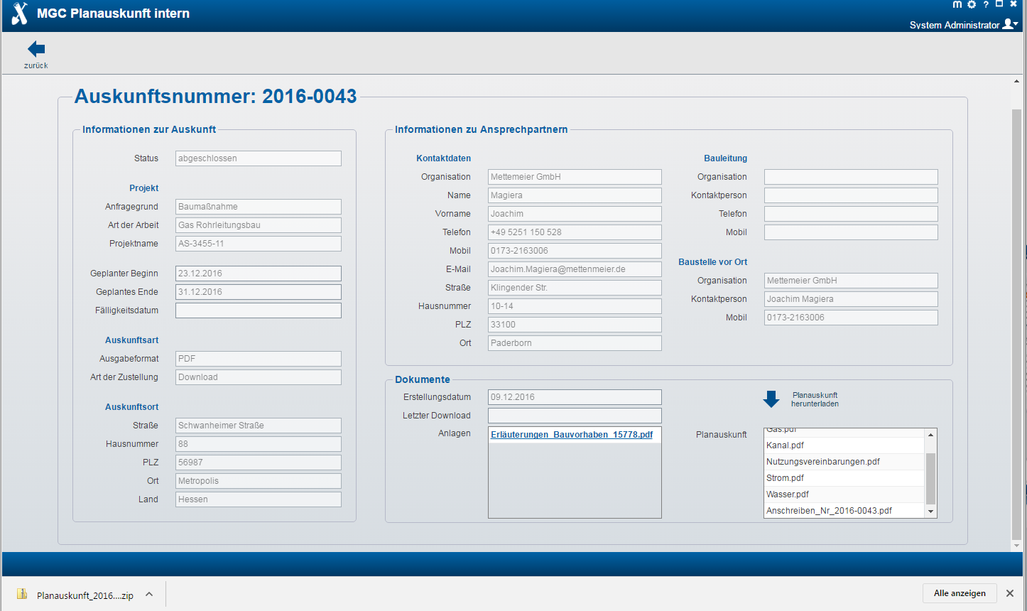
Summary
- Detailed overview of the map enquiry
- Ability to upload documents or change map enquiry documents
Dashboard
- Overview of all enquiries
- Possibility of direct download without confirmation of the user agreement for transfer by printout
Documents and Process Models
- Generation of plots with validity date and overview sheet
- Mail notification or direct dispatch by mail
- Legally secure storage of documents and maps
- Support for comments
- Flexibly adaptable process model, e.g. for one-time requests
Map Enquiry Administration
- Convenient creation of new users and organisations
- Authentification and automatic mail notification on activation
- Determination of an expiry date
Configuration and Defaults
- Definition of organisation-specific settings for the map enquiry system
- Individual selection of mail texts and composite documents
MGC Click Before You Dig
